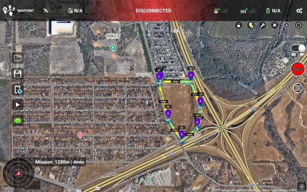
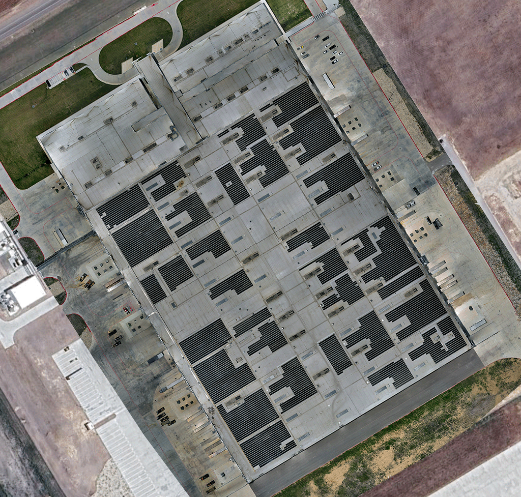
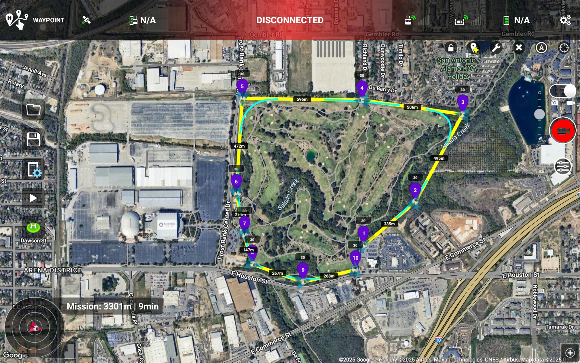
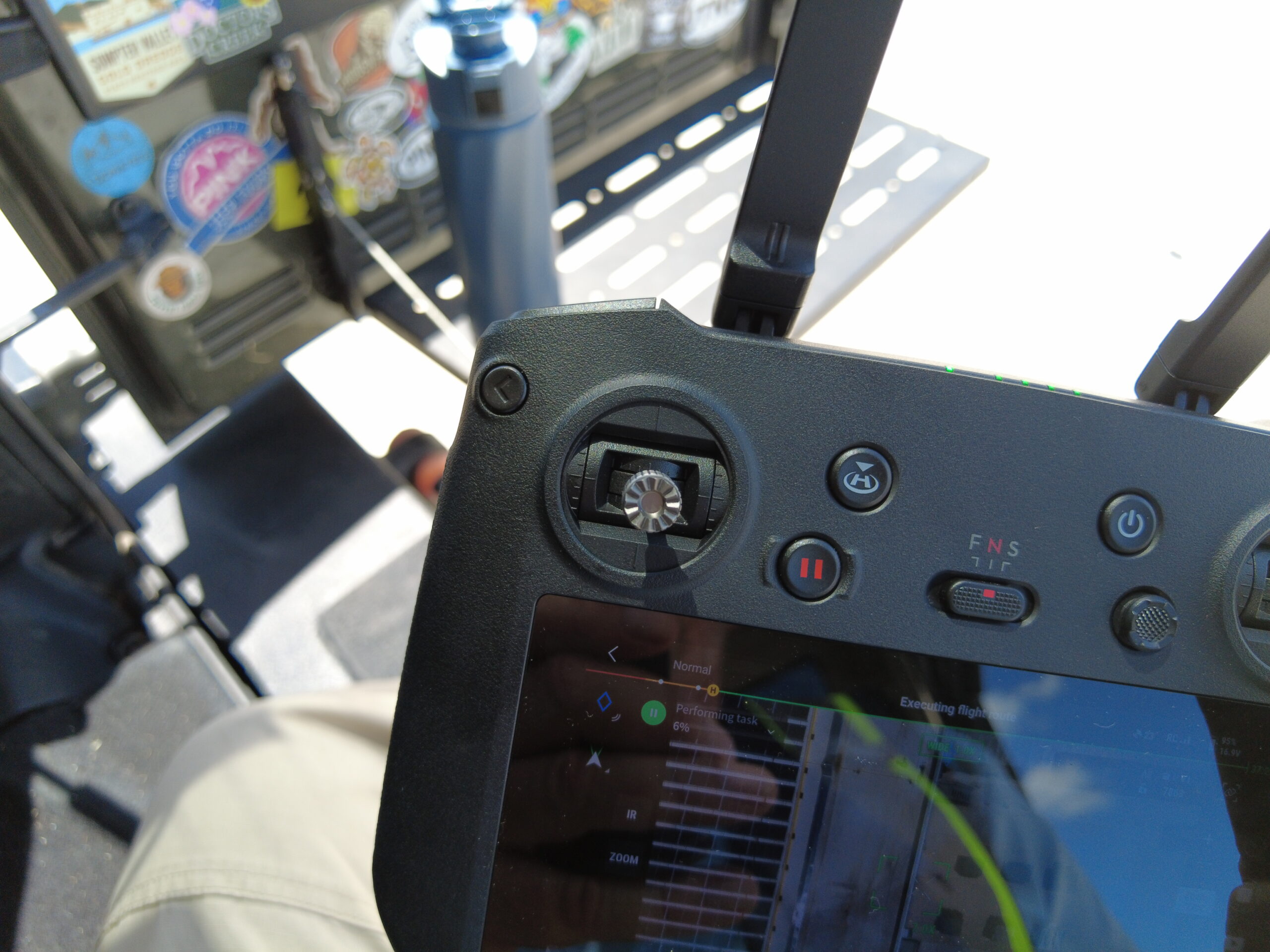
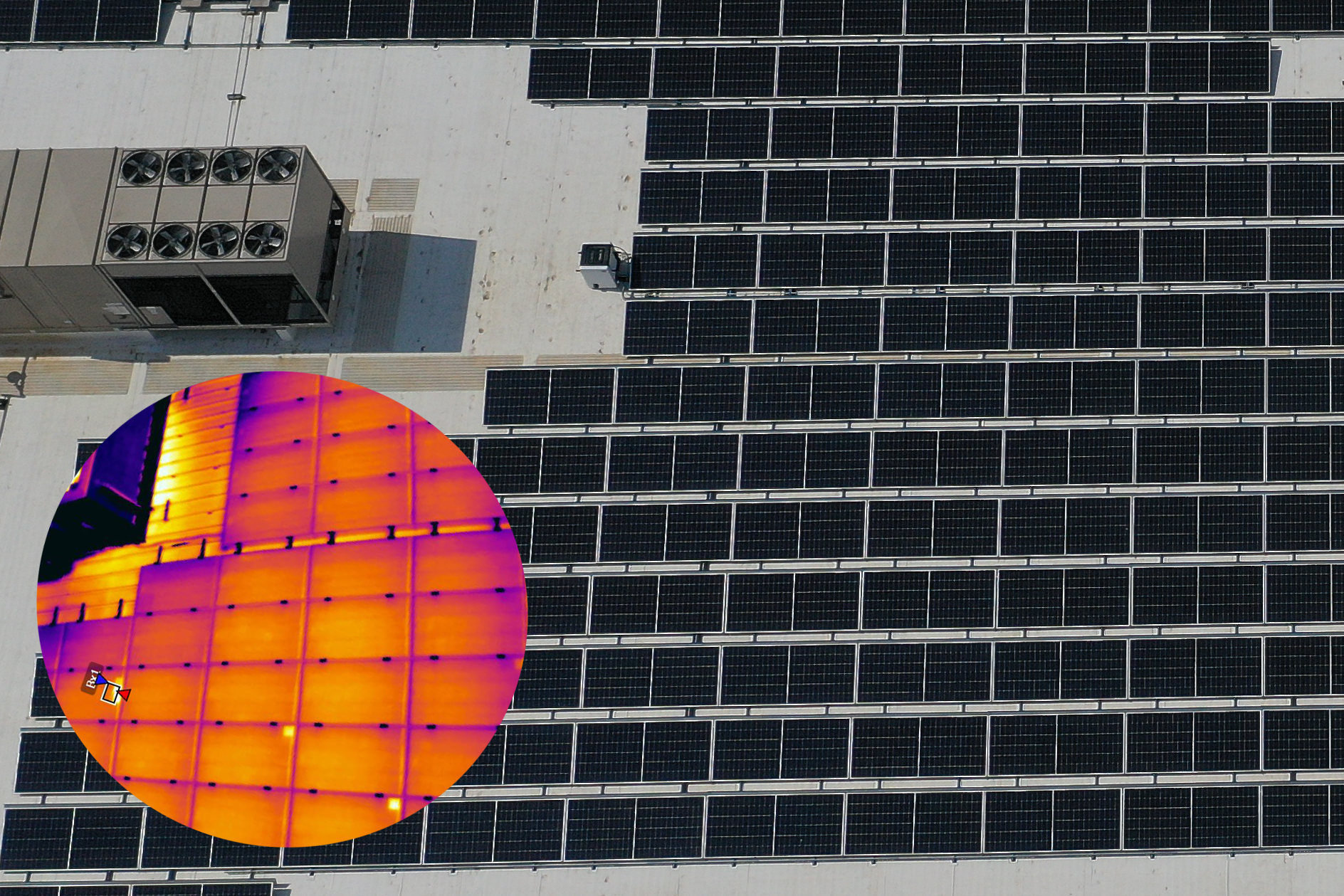
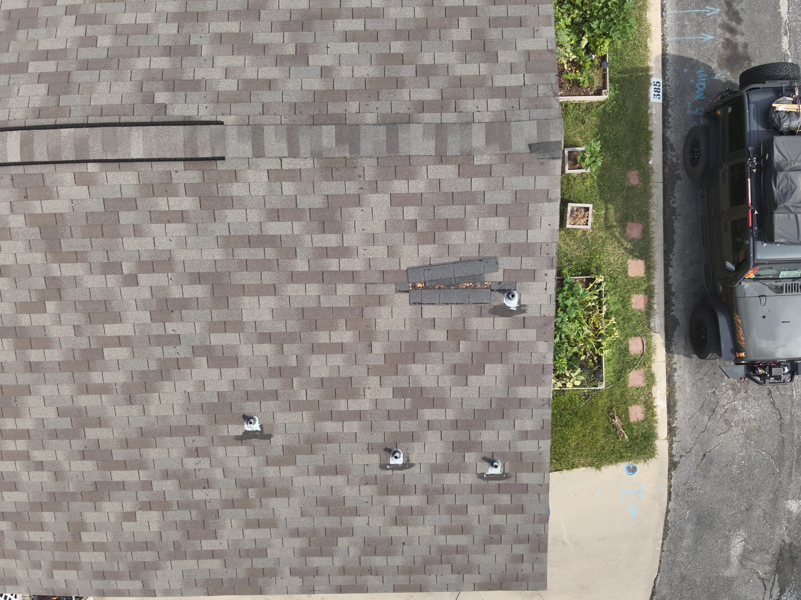
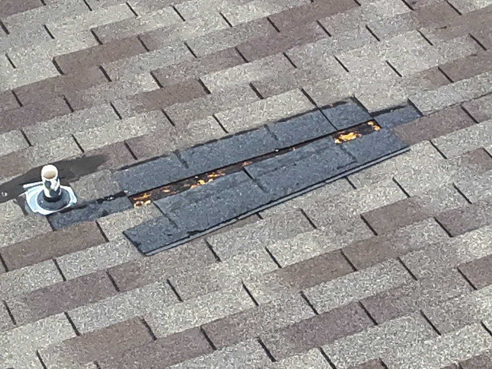
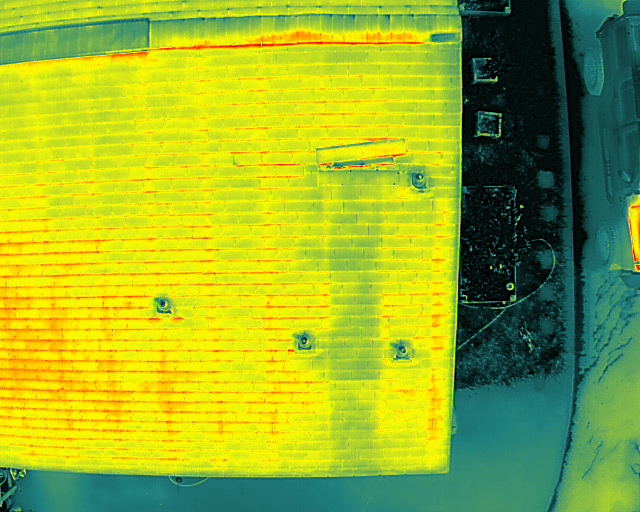
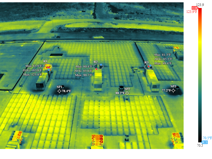
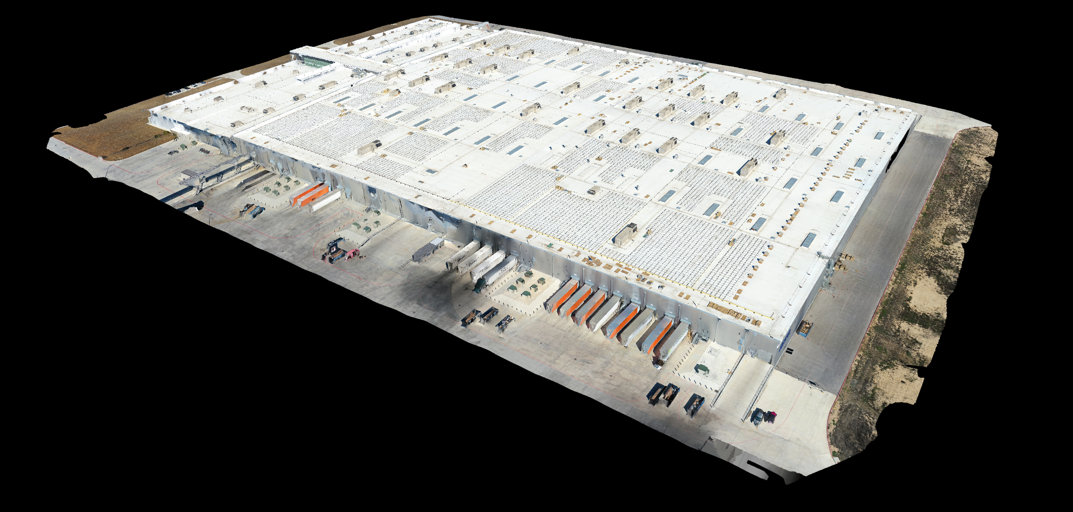
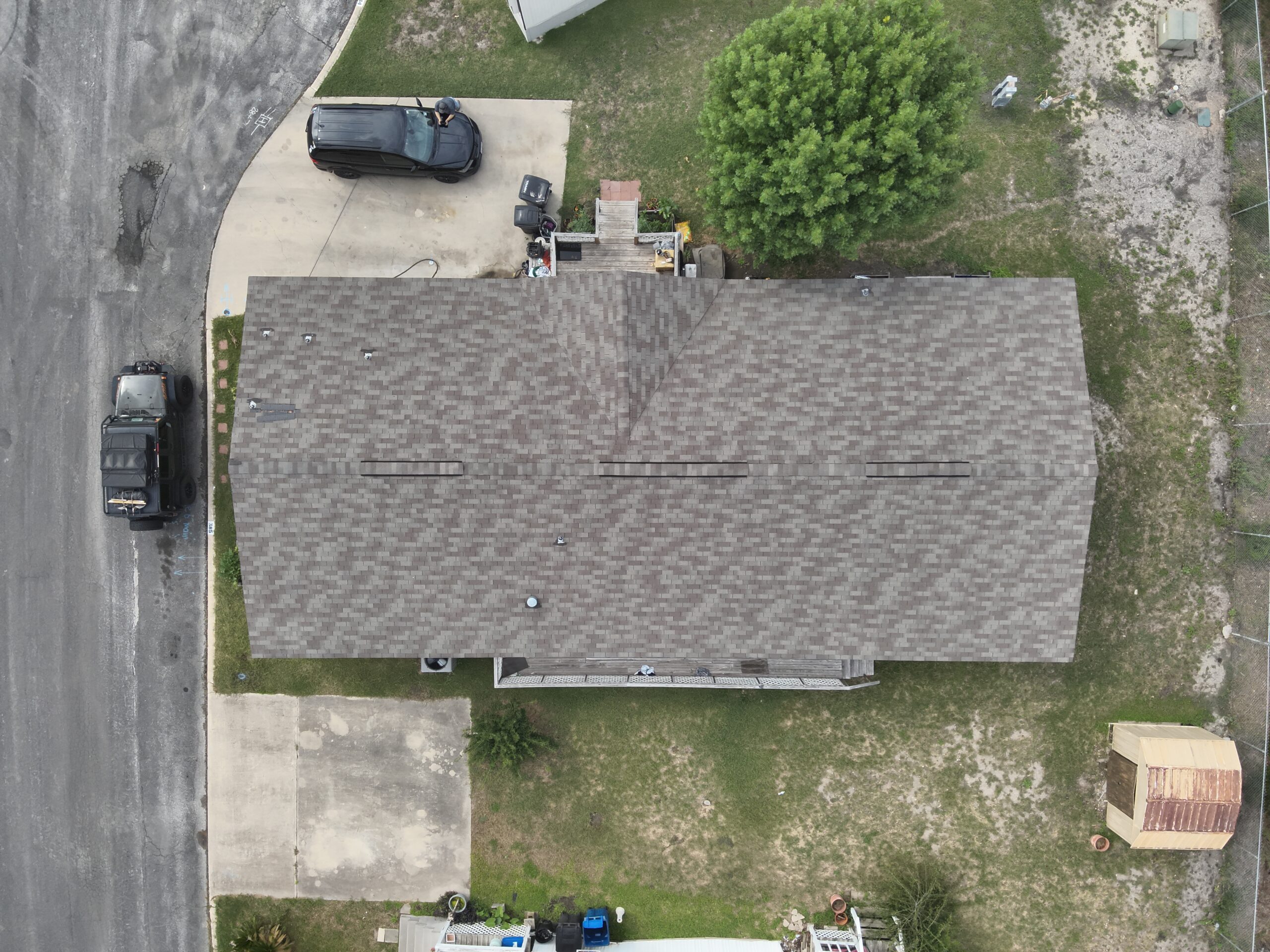
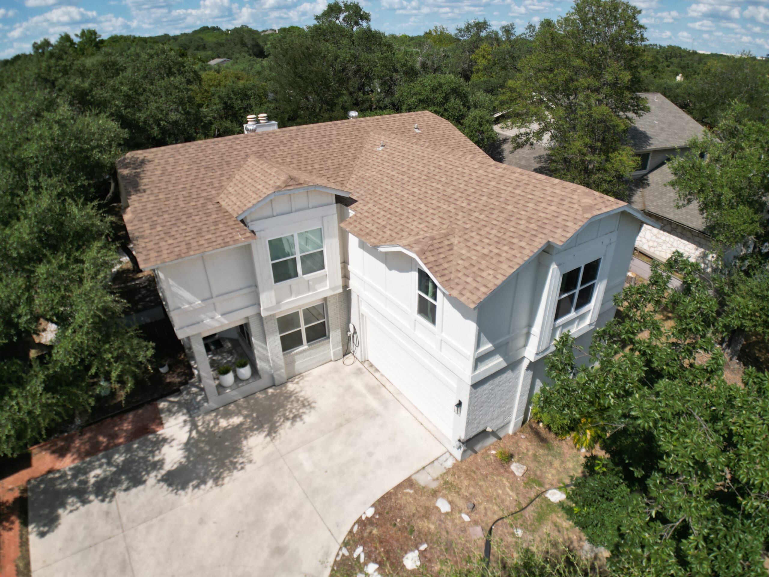
Professional Drone Services
Providing standard and custom drone services - san antonio texas

Marketing
Precision Aerial Optics specializes in high-quality drone marketing videos for events, venues, and commercial properties, delivering stunning aerial footage that captures the scale, energy, and excitement of every location. Whether showcasing sports stadiums, concerts, festivals, or corporate events, our cinematic drone videos enhance brand visibility and engagement. Elevate your marketing with professional drone videography in San Antonio and beyond, ensuring every shot tells a compelling story that resonates with your audience.

Mapping and 3D Modeling
High-accuracy drone mapping and 3D modeling, providing volumetric measurements, land development, and asset management. Our aerial data capture ensures precise mapping for site planning, progress tracking, and geospatial analysis. Whether you need orthomosaic maps, elevation models, or 3D reconstructions, we can provide the critical insights to optimize decision-making and project efficiency.

Inspections
We specialized in high-accuracy drone inspections, providing detailed aerial imagery and thermal analysis for roofs, solar panels, electrical systems, and infrastructure. Our advanced drone technology captures hard-to-reach areas safely and efficiently, reducing downtime and minimizing risks. Whether for preventative maintenance, damage assessments, or compliance checks, we deliver the critical data you need to make informed decisions with confidence.

Project Progression
Comprehensive project progression tracking through high-resolution drone mapping and cinematic video documentation. Our detailed aerial orthomosaic mapping and time-lapse progress videos offer clear, data-driven insights for construction sites, infrastructure projects, and commercial developments. With precise mapping and dynamic visuals, we help teams monitor progress, improve planning, and showcase milestones with accuracy and impact.

More than Drones
At Precision Aerial Optics, we are committed to delivering the highest quality videos, photos, and mapping for every project. With our extensive aviation, construction, maintenance experience including Part 107 FAA licensed pilots, we ensure safe, efficient, and professional drone operations in any environment. Our use of the best processing and editing software guarantees that every aerial shot is polished to perfection, and every map is accurate and reliable. Whether capturing stunning visuals or providing precise data, we go beyond just flying drones—we bring the expertise and tools necessary to provide our customers with the very best in aerial services.

Remote Capability
Precision Aerial Optics excels in remote drone operations, capturing breathtaking off-road, overland, and wilderness footage where others can’t reach. With a fully equipped mobile drone setup, we provide mapping, inspections, and cinematic videography in the most rugged environments. Whether for adventure brands, mapping, or off-grid projects, our expertise ensures high-quality aerial visuals—anywhere your journey takes you.
Talk to us
Have any questions? We are always open to talk about your business, new projects, creative opportunities and how we can help you.